ATIS App
- 4.2
- Rating
- 10.00K
- Installs
- Free
- Price

 Analysis by App-foxy
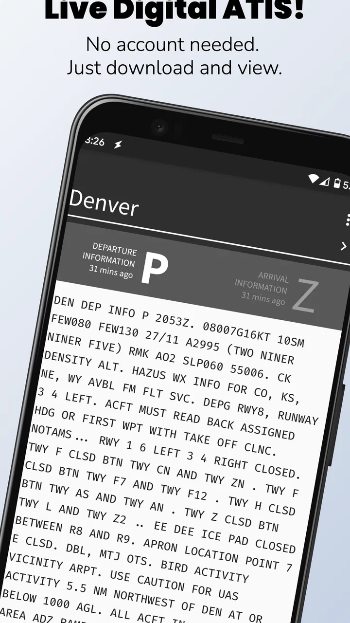
I usually reach for a weather app when I want a quick answer about rain, wind, or temperature. ATIS App serves a much narrower purpose: it brings live Digital ATIS weather reports from the FAA to an Android device. That makes it less of a casual forecast tool and more of a focused companion for pilots, flight students, aviation enthusiasts, and anyone who needs airport information in an operational format.
After spending time with it, my impression is that its value comes from restraint. It is not trying to replace a full aviation planning suite, a radar app, or a general forecast service. Instead, it gives the user a direct way to consult D-ATIS information without sorting through unrelated weather cards. If that is the information you actually need, the focused design is useful. If you simply want to know whether to carry an umbrella, this is the wrong kind of weather app.
What the app is like to use today
ATIS App is a free weather application from iawix ltd., intended for Everyone and available for devices running Android 7.0 or later. Its current version is 3.6.2, and the app has passed the early experimental stage: it has been available since January 30, 2020, and has reached over ten thousand installs.
You May Also Like

 Blood Strike: 2.5 Anniversary
Blood Strike’s Loadouts Turn Every Drop Into a Tactical Gamble
A close look at Blood Strike’s custom loadouts: how fast access to signature weapons reshapes its battle royale rhythm, rewards preparation, and narrows the gap between fights.

 Pandora - Music & Podcasts
Pandora’s Music Is Easy to Start, but Harder to Recover
Pandora’s strength is its low-effort path from a seed to a station. Its weak spot is how much confidence it asks you to place in connection, setup, and quiet recovery.

 8 Ball Pool
 Is Built on Rivalries, Rematches, and Routine
A close look at the rivalries, rematches, shared routines, and unanswered safety questions that turn a quick pool match into a persistent mobile community.

 Samsung Music
’s Quiet Strength Is Playing What You Already Own
Its reach comes less from spectacle than from dependable access to a personal library. That simplicity is both the app’s strongest retention engine and its ceiling.

 AccuWeather: Weather Radar
AccuWeather Review: A Quick, Clear Forecast for Everyday Decisions
For everyday plans, the best forecast is the one you can understand quickly. AccuWeather makes rain timing, radar, and local conditions easy to act on, with a few trade-offs.

 Hill Climb Racing
Why Hill Climb Racing Still Turns Crashes Into One More Run
A tiny car, a bumpy hill and one more upgrade: Hill Climb Racing keeps resurfacing because its simple chaos makes every near-miss feel personal.
More From Our News Desk
View All News


The most important distinction is between ordinary weather information and aviation information. A standard weather app usually emphasizes visual forecasts, hourly conditions, precipitation maps, alerts, and location-based convenience. This app is built around Digital ATIS reports, so the useful question is not “What will the weather feel like this afternoon?” but “What is the current airport information being transmitted through the FAA’s D-ATIS system?”
That difference affects the whole experience. I would not open it expecting a polished travel dashboard with every possible layer. I would open it when I wanted to check airport-specific information in a form closer to the operational source. For a pilot preparing for a departure, a student practicing information gathering, or someone monitoring conditions at a particular airport, that directness can save time.
The app’s store summary is brief, but the practical implication is more interesting than the wording suggests. A live ATIS report is not simply another temperature reading. It can be part of the information a pilot reviews before operating at an airport. That means the app is most helpful when used as one piece of a wider process rather than as a complete replacement for flight planning, official communication, or current instructions from air traffic services.
A focused tool rather than a complete flight-planning system
This is the first trade-off I noticed. The narrow scope makes the app easier to understand, but it also means that users looking for charts, route planning, navigation, detailed forecasts, or broad weather analysis will need other tools. I would keep this app beside those services, not mistake it for an all-in-one aviation package.
That separation is actually useful in practice. When I want to check a report, I do not need to wade through a long forecast screen first. The app’s purpose is clear enough that it can occupy a small role in a larger workflow: open it for the D-ATIS information, then use an appropriate aviation or official source for everything else.
One practical habit is to treat the displayed report as time-sensitive. Live aviation information changes, and a report that was useful a few minutes ago may no longer represent the situation you are preparing for. I would refresh or recheck the information at the point in the workflow where it matters, rather than reading it once and assuming it remains current throughout a flight day.
Who benefits most from the narrow focus
ATIS App makes the most sense for recreational pilots, student pilots, flight instructors, aviation students, and airport watchers who specifically want FAA D-ATIS reports. It can also be useful for someone who already has a preferred navigation or planning application but wants a separate, uncomplicated way to consult this particular source.
For a student, the app may help build a repeatable information-checking routine. Instead of treating weather as a single icon or color, the student can make airport information part of the preparation sequence: identify the relevant airport, review the current report, note the important conditions, and then continue with the rest of the required checks. The app does not perform that judgment for you, which is a limitation for beginners but also a reason it can fit into proper training.
It is less suitable for a traveler who wants a friendly forecast for a road trip, a family that needs severe-weather notifications, or a user who expects detailed maps and long-range predictions. The app’s value depends heavily on whether D-ATIS is part of your actual need. If it is not, the focused interface may feel empty rather than efficient.
What the version history suggests about its development
The current release, 3.6.2, shows that the product has continued beyond its original launch. I see that as a positive sign for a specialized utility: an app dealing with live aviation information needs maintenance, and a current version is preferable to a project that appears abandoned. At the same time, a version number alone does not tell me that the app has become a full-featured aviation platform, so I would keep expectations centered on its core purpose.
Its average rating is 4.2 from 69 ratings, with 25 written reviews. That is encouraging for a small, specialized app, although the relatively focused audience means I would interpret the rating as a signal of usefulness to its intended users rather than a universal recommendation. Someone who understands D-ATIS may value the app much more than someone who has never encountered an aviation information service.
The developer, iawix ltd., has kept the product positioned as an ATIS utility rather than turning it into a generic weather brand. From a user’s point of view, that consistency matters. The app is easier to judge when its purpose remains specific: either the FAA reports are accessible and convenient for your workflow, or they are not the information you need.
There is also a financial detail worth considering. The app is free to install, while in-app purchases are listed at $4.99 per item. I would check what a purchase unlocks inside the current build before paying, especially because the free entry point already lets users evaluate whether the basic experience fits their needs. For a specialized app, trying the core workflow first is more sensible than assuming every user needs the paid option.
How the current release affects an existing user
If you already use the app, the main benefit of staying current is less about chasing novelty and more about maintaining compatibility with the service and modern Android devices. A live-data utility depends on its connection to the information it presents, so an up-to-date build is the sensible choice when available. I would not delay an important aviation check simply because the app is convenient; I would use it alongside the normal sources and procedures that apply to the flight.
For a new user, the current version also lowers the risk of judging the app from an old installation. That matters with small utilities because a dated build can create problems that have nothing to do with the concept itself. My advice would be to install it well before you need it, test the airport-selection and report-reading routine, and learn where the information appears while you are on the ground.
That last point is more important than it sounds. A tool can be perfectly useful in a calm setting and awkward when you are rushing through preparation. I would create a simple personal routine: open the app, locate the airport, read the report carefully, note the relevant information, and confirm anything operationally important through the required official channels. Practicing that sequence removes unnecessary friction later.
A realistic everyday aviation scenario
Imagine a student pilot preparing for a local training flight. Before leaving for the airport, the student checks a general forecast to understand the broader weather pattern. Then the student opens ATIS App to review the airport’s current D-ATIS information. The two checks answer different questions: the forecast provides context, while the airport report gives a more immediate operational picture.
In that situation, the app is helpful because it occupies a precise step. It does not force the student to replace the forecast service, and it does not pretend to replace instructor guidance or official procedures. The student can use the report as a prompt to pay attention to current airport conditions, then continue with the rest of the briefing.
For an experienced pilot, the same workflow may be quicker. The app can serve as a dedicated reference when the user already knows which airport and which pieces of information matter. The trade-off is that experienced users may also want more tools in one place, so the decision depends on whether a separate D-ATIS utility is faster than navigating through a larger aviation application.
Small workflow insights that make a difference
My first practical tip is to separate “access” from “decision-making.” The app can help you access a live report, but the report should not be treated as a complete go-or-no-go answer. Weather decisions require context, training, aircraft limitations, airport conditions, and current official information. Keeping that boundary clear prevents the app from being used beyond its proper role.
My second tip is to compare the report with your broader weather picture instead of reading it in isolation. A D-ATIS report may be highly relevant at the airport while the route or destination presents different concerns. Using the app as a focused airport check, rather than as your only weather source, gives it a stronger place in a responsible workflow.
My third tip is to test it at the airports you actually care about before relying on it. A specialized app can be excellent in concept but less useful if your regular airport is not part of your normal workflow or if the information is not presented in the way you expect. A short trial during ordinary preparation will tell you more than a store description.
A fourth insight is that a separate app can reduce cognitive clutter. Large aviation platforms are powerful, but they can also place charts, traffic, forecasts, notices, and settings on the same screen. If your immediate task is simply checking D-ATIS, a dedicated tool may be easier to open and close. The downside is having another app to maintain and another interface to remember.
Where it still falls short
The biggest limitation is the narrow audience. Someone searching for a normal daily weather app will probably find the experience too specialized. There is no reason to choose a D-ATIS-focused tool when your real needs are hourly forecasts, rain radar, pollen information, local alerts, or a simple temperature widget. A mainstream weather service will be a better fit for those tasks.
It also should not be your only aviation resource. The app’s central strength is access to a particular kind of report, not comprehensive flight preparation. I would still use the official communication methods, approved procedures, and other planning resources appropriate to the operation. Treating one convenient screen as the entire weather briefing would be an avoidable mistake.
The free model may also require a closer look before committing to long-term use. Since optional purchases are priced at $4.99 per item, I would first establish whether the free experience covers the airports and workflow I need. That is especially important for occasional users, who may not gain enough from an upgrade to justify paying for it.
Another potential source of friction is audience knowledge. The app may be straightforward for someone who already understands ATIS terminology, but a newcomer could see a report full of abbreviations and operational detail without knowing what deserves attention. I would not recommend it as a stand-alone teaching tool. A student should learn the meaning and use of the information from an instructor or reliable training material, then use the app as a practical aid.
There is also a difference between a live report and a convenient report. Even if the app presents the information clearly, the user still needs to confirm that it is the right airport and sufficiently current for the task. My own approach would be to slow down at those two points rather than assuming that a quick glance is enough. In aviation, the most useful interface is still one that encourages careful identification and timing.
When another option is the better choice
I would choose a broader aviation application when I need navigation, charts, route planning, traffic, notices, or several weather layers in one workflow. I would choose a mainstream weather app for household planning and general forecasts. I would choose official channels and established operational procedures whenever the information affects an immediate flight decision.
ATIS App is better when the specific task is checking FAA D-ATIS information with minimal distraction. That sounds modest, but specialized tools can be valuable precisely because they do not attempt to do everything. The right comparison is not whether it beats every aviation app; it is whether it makes this one job easier for the people who regularly perform it.
What I would watch as the app continues
For future updates, I would pay attention to how consistently the app handles live information, how clearly it communicates the freshness of a report, and whether the airport-selection process remains quick under real preparation pressure. Those details matter more to me than decorative interface changes because they affect trust and usability.
I would also watch how the paid elements develop. A purchase can make sense if it adds meaningful convenience for frequent users, but the value should be obvious before payment. For occasional pilots or students, the free experience needs to remain useful enough to evaluate the app honestly.
Finally, I would look for continued maintenance without expecting the product to become something it was never designed to be. The strongest future for this app is probably not uncontrolled expansion into every aviation feature. It is reliable access to its core information, a clear workflow, and careful separation between a convenient report viewer and the wider responsibilities of flight planning.
My final opinion is favorable but specific. I would recommend ATIS App to a pilot or aviation student who wants a dedicated way to consult FAA D-ATIS reports and already understands that this is one part of a larger preparation process. I would not recommend it to someone seeking an everyday weather companion or a complete flight-planning suite.
The app earns its place through focus rather than breadth. Its free entry point, current version, and continued presence make it easy to try, while the 4.2 average suggests that its intended audience generally finds value in it. Just remember the central trade-off: it can simplify access to a specialized aviation report, but it cannot replace sound judgment, official procedures, or a complete weather briefing.
FAQs for ATIS App
01What is the ATIS App used for?
ATIS is generally designed to provide access to aeronautical information services, helping pilots and aviation personnel review important airport and flight-related updates. Depending on the version and region, the app may include automatic terminal information, weather details, runway status, operational notices, and other relevant data. Users should check the official listing to confirm which features are available in their country and for their specific aviation needs.
02Does ATIS provide real-time aviation information?
The usefulness of ATIS depends on how frequently its information is updated and on the data sources connected to the application. It may display current airport or terminal information, but users should not automatically assume that every item is updated instantly. Before relying on the app for an actual flight, compare its information with official aviation channels, airport communications, NOTAM services, air traffic control, and approved flight-planning resources.
03Is the ATIS App suitable for professional pilots and flight operations?
ATIS can be a convenient supplementary tool for pilots, students, dispatchers, and aviation enthusiasts who want quick access to operational information. However, it should not replace certified navigation equipment, official briefing services, air traffic control instructions, or procedures required by aviation authorities. Professional users should verify whether the app is approved or accepted for their operation and should always use authoritative sources for safety-critical decisions.
04Does ATIS require an internet connection or location access?
Many ATIS-related features depend on an internet connection because the app may need to retrieve current airport, weather, or operational data from online services. Some functions could work with previously loaded information, but offline availability should not be assumed. Location permission may also be requested to identify nearby airports or tailor results to the user’s position. Review the permissions carefully and enable only those needed for the features you intend to use.
05Is the ATIS App free to download and use?
The ATIS app may be available as a free download, although certain features can require in-app purchases, a subscription, an account, or access to a separate aviation data service. Pricing and availability can vary between Android and iOS and may change over time. Before installing, check the official store page for current costs, supported devices, subscription terms, privacy information, and whether the app includes advertising or usage limitations.
Pros
- Quick access to real-time public transport information.
- Clear interface makes route planning easy for new users.
- Useful notifications help track service changes and delays.
- Supports more confident travel in unfamiliar areas.
- Lightweight design works well on most modern smartphones.
Cons
- Coverage may be limited outside supported cities or transport networks.
- Live arrival data can be inaccurate during service disruptions.
- Some features may require location access and mobile data.
- The app may feel less useful in areas with infrequent transit.
- Battery use can increase when location tracking stays enabled.

ATIS App
Gallery